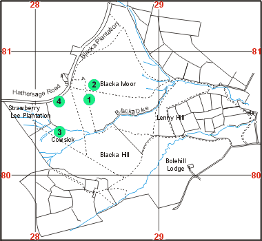
Past students have recorded vegetation and soil data for four sites on Blackamoor. The locations from which samples have been taken are shown on the map to the right.
To see a summary of the data that has been collected click on the circle for the site you are interested in.